3D scanning objects and buildings
3D scanning of objects, buildings, and natural surfaces in a real environment or during operation
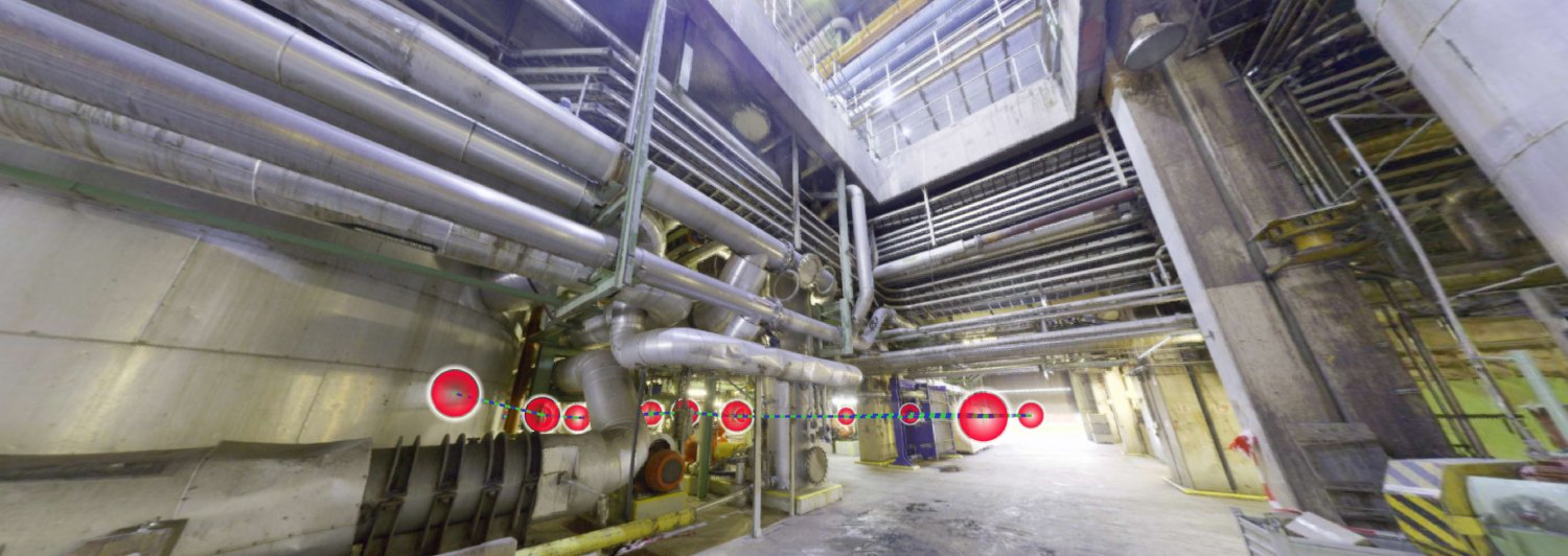
We provide an accurate scanning of the real environment in 3D. For our activities we use a professional 3D scanning device Leica RTC360 that allows users to document and capture real environments of buildings, objects, or natural formations into 3D, regardless of their size and shape. Thanks to the possibility of georeferencing, it is possible to use the resulting data in both 2D and 3D.
Advantages of laser scanning
• All outputs are created with the utmost accuracy and speed, in formats applicable in most 2D and 3D programs • The shapes of buildings and objects are not important as they are always captured with the utmost precision and very quickly • Fast reading speed enables the capture of data that is often immeasurable by other devices and technologies • 3D scanning can be performed during operations • Georeferencing, i.e., Point Cloud in WGS-84 or S-JTSK coordinates • Colourising Point Cloud by using photography • For all situations, only one 3D scan of the environment is sufficient to draw all the data for both, 3D and 2D, with maximum accuracy • Thanks to the 3D scan, a complex surveying documentation will be created ensuring that even the most demanding of requirements can easily be met • Cost savings associated with consequent measuring • Possibility of accurate measurement under adverse conditions (confined space, reduced visibility or darkness) • The possibility of using the output from the 3D scan for the precise orientation and condition in any given location, usable for both – control and orientation, or planning without the need for the physical inspection of the location • Option to set automatic removal of moving objects • High scanning speed, up to 2,000,000 points per second • From the output in 3D, it is possible to form 2D plans, BIM objects • You can enter your own point description into the final 3D plan
3D scanning options
• Precise object targeting using a 3D scan • Processing cloud points and its location in the cloud, on a PC or server and creating a webshare project • Creation of precise BIM objects from 3D scan data • Facade focus or other parts of buildings and objects, regardless of the complexity of the shape itself • Delivery of bitmap and vector slices as well as views in 2D • Evaluation of object distortions or shifts • Accurate calculation of soil and other material volumes • Creating render images with real surfaces • Scanning natural surfaces such as rock formations, glaciers, mountain slopes and hills